Iceland mapped by Danish authorities
Iceland was part of the Danish kingdom until 1944, one of its several overseas territories. Starting in the late 18th century, the Danish authorities undertook some major initiatives to systematically map this corner of the kingdom. The first of those was coastal surveying of the west of the country. In the early 19th century, coastal surveys were continued, and the country finally acquired the shape that appears on later maps.
Around the turn of the 20th century, an extremely ambitious surveying and mapping project was started, which eventually covered the entire country and was not completed until 1944, on the eve of Iceland becoming a republic. This great work was carried out by the topographical department of the Danish Army (Generalstabens Topografiske Afdeling) and later by the Danish Geodetic Survey (Geodætisk Institut). Teams of surveyors undertook lengthy expeditions in the country with their tools and instruments, determined geographical coordinates, established a triangulation network, measured distances and elevations, collected place names – and drafted maps.
This exhibition offers a little insight into the immense work that went into this project. On display from the coastal surveys that were initiated are several published charts, which helped seafarers to navigate the landscape along the country’s coasts. From the great mapping initiative that began at the start of the 20th century, you can view sketches and working drawings of farms and settlements, hand-drawn maps with place names, stereographic images, and photographs of surveyors at work in conditions that were very different from their home country.
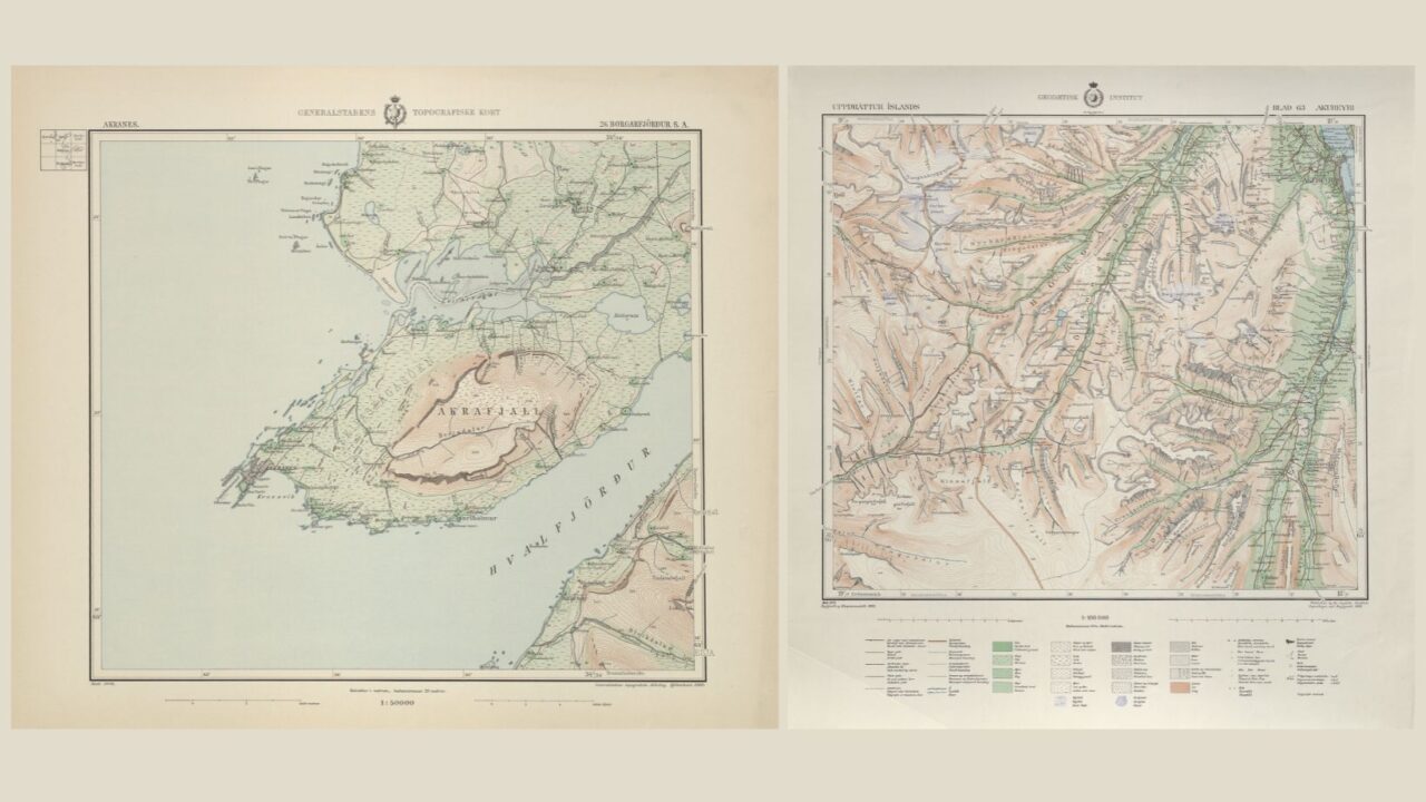
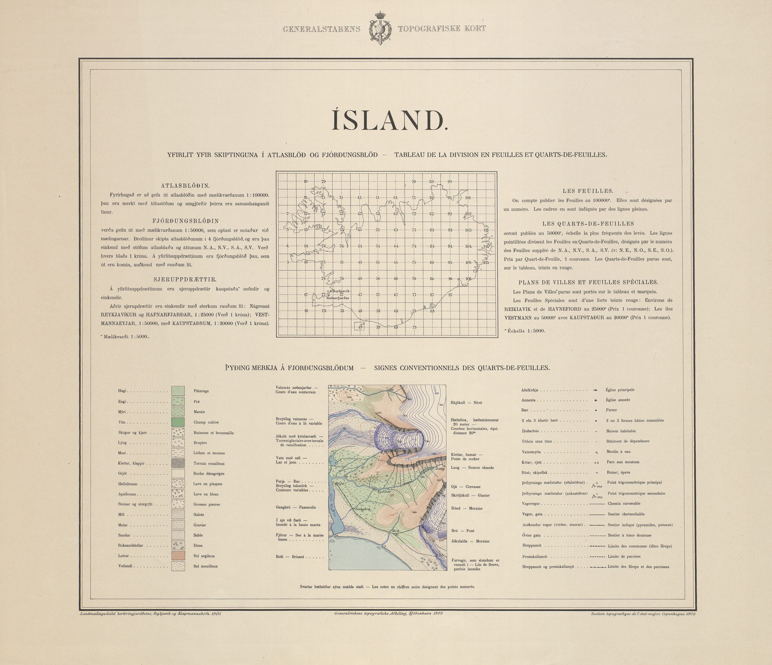
The final products were the so-called General Staff Maps (Herforingjaráðskort), a series of topographic maps in scales of 1:50,000 and 1:100,000. They can be viewed in the book Islands Kortlægning, which was published in 1944 and marked the end of the mapping project. The maps are not only a testament to scientific accuracy and skilful surveying, but they are also artfully produced and bear witness to great sensitivity to the unique features of this rugged island. They are still considered among the most aesthetically pleasing maps ever made of Iceland.
![]()